


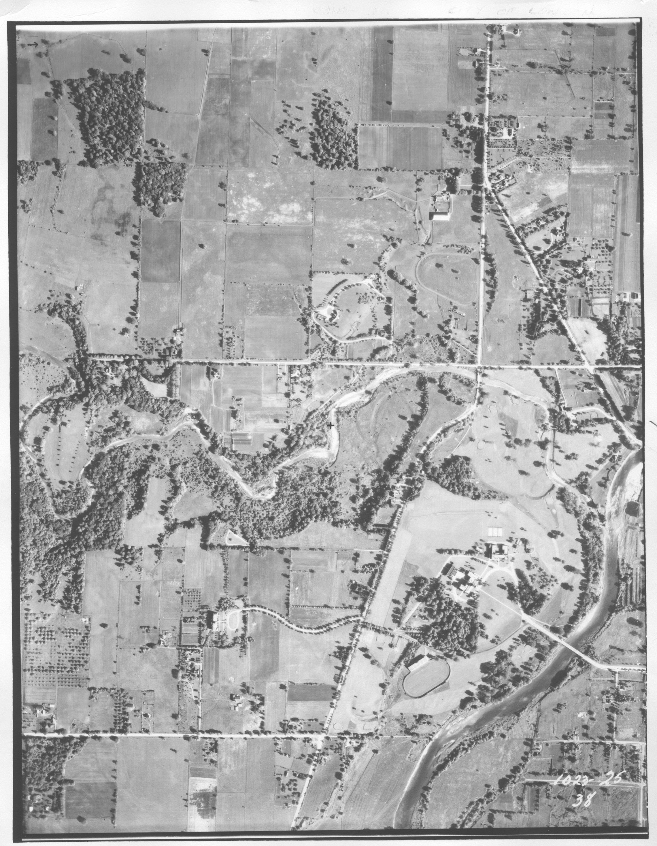
If you had a bird’s-eye view of London’s ‘Calamity Corners’ at the close of the Second World War, you’d see three tree-lined farm fields, half-dozen houses and one-roomed school – and no hint of the bustling Masonville shopping and residential district it would become.
Or if, on a 1950 flypast, you cast your eyes down to the criss-cross of fenceposts marking south London’s rural property lines, nothing in your sightline would presage what the Wellington Road/Highway 401 cloverleaf that now sees 38,000 vehicles daily.
Most of the time, it is easy to forget that London didn’t always look the way it does now. Now, an online app spanning the past 100 years of aerial photography in London is helping us remember.
The GIS database of 3,183 images from 1922-2001 is part of the Western Libraries Map & Data Centre, located online and at The D.B. Weldon Library.
Aerial maps are the most-used part of the map collection, said Liz Sutherland, GIS Technical Specialist, Map & Data Centre and creator of the new tool. And until now, the most effective – although not very efficient – way of finding a specific aerial image was “coming into the library and searching through thousands of photos,” Sutherland said.
The new database and app allow real and online visitors to find and compare images of specific sites across time, or simply to fly over the city virtually to ‘see’ what the cameras saw.
She said visitors to the map centre usually fall into three categories: curious Londoners wondering what their favourite neighbourhood once looked like; environmental scientists and geographers needing to overlay data physical data over time; and professional consultants wanting to conduct site assessments in advance of designing development projects.
This app replaces a more clunky and less searchable Google Fusion Tables, a web format for organizing and visualizing data tables.
Whether as a toy for the curious public or a tool for professionals, the collection is available free for use by everyone.
It is likely your neighbourhood – whether it’s in older London or in newer subdivisions – is also depicted somewhere in one or more images. (Tip: Be sure to look for the map’s North arrow when orienting yourself in space; many images are shown in the direction in which they were shot, not necessarily according to compass points.)
People can also apply layers to the page to compare nearby locations across time or generate a map of year-specific flyovers.
The 1922 and 1945 layers, for example, show a west-east crisscross flight path that cover core populated areas. The 2001 collection is a systematic survey of larger London, including Lambeth, Arva and Glanworth.
The 30 photos from the 1964 flyover, by contrast, appear chosen as randomly as if the photographer had shot at a map.
Images dating back from 1922-68 are available both online and in paper copy.
Newer images, from 1970-2001, are not yet permitted online because of copyright laws, but instead provide reference to the roll where physical copies can be found in in the map library.
Creating and inputting geolocation data for the early photos was sometimes a matter of detective work because photographers didn’t necessarily tag the locations on the image.
The aerial surveys were commissioned variously by the City of London, the Ministry of Natural Resources and the Forestry Department (and their various iterations through time), surveying companies and private pilots/photographers looking to sell the images to property owners.
“In the 1920s, there would literally be a guy in a fixed-wing aircraft with their 1920s camera, leaning out the window and taking these photos,” Sutherland said.
Later photography took place with cameras affixed to the body or a wing of the plane.
Some of her favourite photos show Western in its smaller early years, including a 1945 image of what was then a winding path leading up the hill to Brescia University College.
Apart from Sutherland’s professional interest, the photos intrigue her for historic reasons. “It’s just seeing the world from a different perspective. When you compare and contrast, you can see what has changed over the years.”
